Quick answer
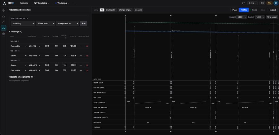
A utility long section uses two distorted scales, for example 1:500 horizontal and 1:100 vertical, so slopes and clearances stay legible over long distances. Read the ground line, the pipe invert (gravity sewers) or axis (pressure mains), and the stationing along the bottom; then check the profile table below the drawing, where cover depth, gradient per reach, invert levels and crossings are actually verified against the standard, not just drawn.
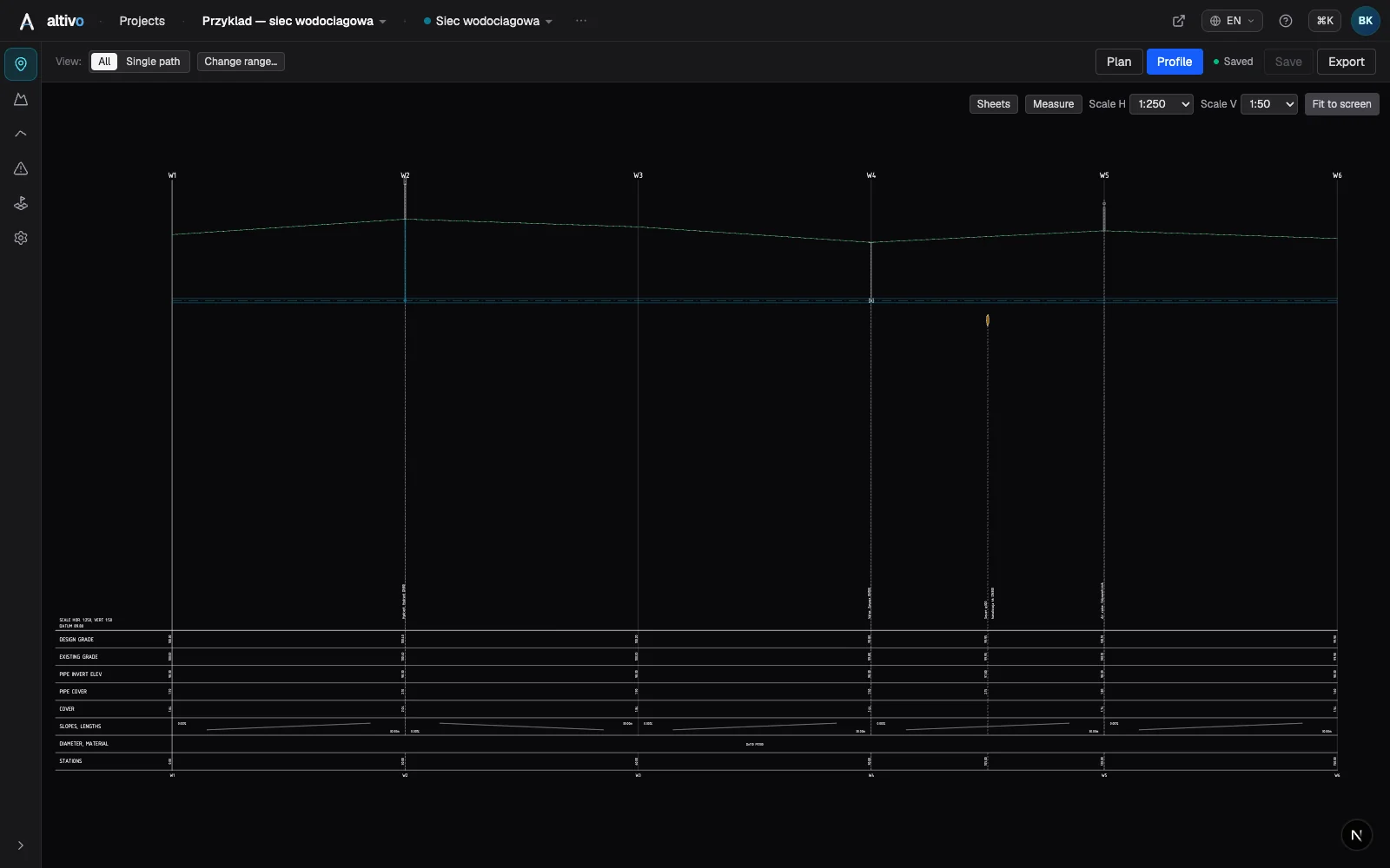
The long section (longitudinal profile) is the drawing that tells you whether a utility network actually works in the vertical plane. The plan view shows where the pipe goes; the long section shows whether it can go there — at the right depth, with the right slope, without colliding with everything else underground. Here is how to read one.
The two scales
The first thing to notice is that a long section is distorted on purpose. Horizontal distances span hundreds of metres; the vertical differences that matter are centimetres and metres. So the drawing uses a dual scale — for example 1:500 horizontally and 1:100 vertically. The vertical is exaggerated 5× here so slopes and clearances are actually legible. Read every height off the vertical scale, every chainage off the horizontal one, and never scale a slope angle directly off the sheet.
The lines
- Existing ground line — the terrain as surveyed.
- Designed ground line — where present, the finished surface after earthworks.
- Pipe line — for a gravity sewer this is the invert (channel bottom); for a pressure main (water, gas) it is the axis. This distinction is not cosmetic: a gravity system is designed from the invert up, because the invert and its slope are what move the flow.
Stationing (chainage)
Along the bottom runs the stationing — distances measured from a zero point, often in hectometre form. Every manhole, bend and crossing is tied to a station. Stationing is how the long section, the plan and the schedule of structures all refer to the same physical point.
The profile table
Below the drawing sits the table — the part a reviewer reads first. Typical rows:
- existing and designed ground level,
- pipe invert (or axis) level,
- cover depth,
- gradient per reach (‰ or %) and reach length,
- diameter and material,
- vertical/horizontal angles,
- drop (cascade) at a structure.
Each column lines up vertically with its point on the drawing. The table is where the design is actually verified — the picture is the summary, the numbers are the proof. Where those gradient values come from, and how to defend them to a reviewer, is covered in the gravity sewer gradient design guide.
What a reviewer checks
Reading a long section critically means asking the questions a checker asks:
- Is the cover depth sufficient along the whole route (frost, traffic loading)?
- Is every gradient within the minimum (self-cleansing) and maximum (velocity) bounds for that diameter?
- Do invert levels match between the table and the drawn line at every manhole?
- Are crossings with other utilities shown with their conflict level, and is the clearance real?
- Where the invert steps down, is there a drop connection rather than an impossible kink?
From reading to producing
Once you can read a long section, producing one is mostly discipline: resolve every level, keep the table consistent with the drawing, and export something a reviewer can open without cleanup. That last part — a clean, dual-scale, deliverable DXF — is where most of the time leaks. Altivo does exactly this, step by step, and the gradient design rules are here.
Frequently asked questions
What is a long section (longitudinal profile)? A long section, or longitudinal profile, is the drawing that shows whether a utility network works in the vertical plane. The plan view shows where the pipe goes; the long section shows whether it can go there — at the right depth, with the right slope, without colliding with other buried services. It presents the ground line, the pipe line, gradients, stationing and a profile table below the drawing. See how to read one for the detail.
Why does a long section use two different scales? A long section is distorted on purpose. Horizontal distances span hundreds of metres while the vertical differences that matter are centimetres and metres, so the drawing uses a dual scale, for example 1:500 horizontally and 1:100 vertically. That exaggerates the vertical, here five times, so slopes and clearances stay legible. Read every height off the vertical scale and every chainage off the horizontal one, and never scale a slope angle directly off the sheet.
What is the difference between pipe invert and pipe axis on a profile? For a gravity sewer the pipe line drawn is the invert, the channel bottom, because a gravity system is designed from the invert up — the invert and its slope are what move the flow. For a pressure main such as water or gas, the pipe line is the axis instead. The distinction is not cosmetic; it changes which level the design is built around.
What does a reviewer check on a long section? A checker asks whether cover depth is sufficient along the whole route for frost and traffic loading, whether every gradient sits within the minimum self-cleansing and maximum velocity bounds for that diameter, whether invert levels match between the table and the drawn line at each manhole, whether crossings show their conflict level with real clearance, and whether the invert steps down through a drop connection rather than an impossible kink.
Try Altivo free — 14 days, no card required.
Related articles
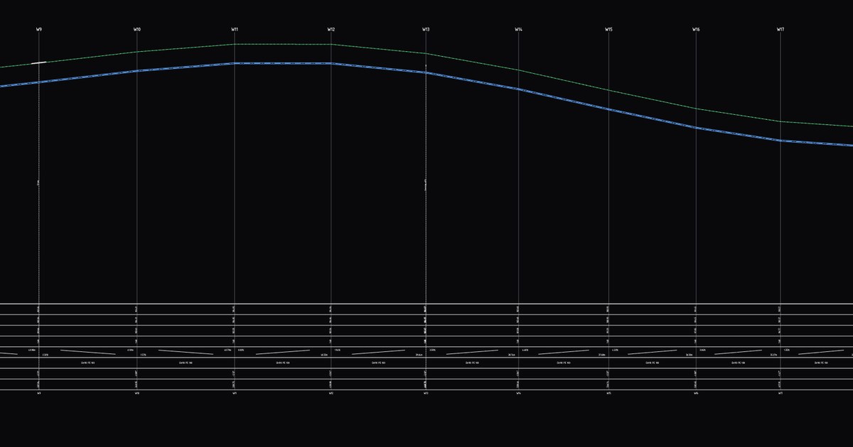
Crossings and objects on the profile — how to add and edit them
Step by step: how to place utility crossings and objects (manholes, roads, buildings) on a long-section profile in Altivo, how to edit their parameters and how to delete them.
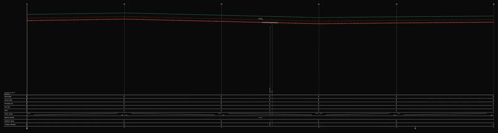
Underground cable long section — power and telecom cable routes
How to draw the longitudinal profile of a buried power or telecom cable route: minimum burial depth by voltage class, crossings, protective ducting, warning tape and a DXF export — in the browser, no CAD.
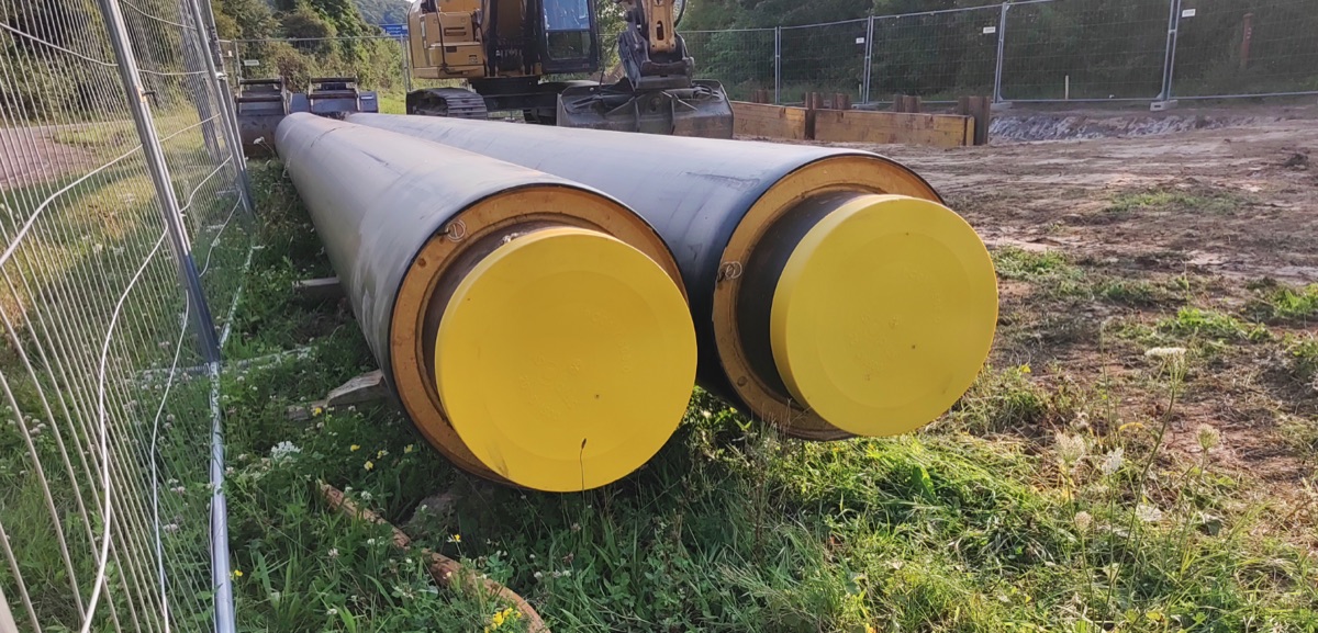
District heating long section — preinsulated pipe in profile
How to draw the longitudinal profile of a district heating network with preinsulated bonded pipe: two diameters (carrier and casing), cover to the casing crown, leak detection, crossings, the profile table and a DXF and IFC export — in the browser, no CAD.
Water main long section to DXF — step by step
How to draw a water main longitudinal profile: minimum cover vs frost depth, pipe centreline levels, valves and hydrants, crossings, the profile table and a clean dual-scale DXF export — in the browser, no CAD.
Ready to design without the pain?
Altivo is the fastest way to produce a clean DXF. Try it today.
Start the 14-day trial